
Description
Military GPS Survival Kit is 13 easy to use tools and technologies specifically designed for both professional and amateur military personnel bundled in an easy to use interface.
Why choose Military GPS Survival Kit? Each tool is developed with a unique and detail-oriented approach, and included together in one application. You can fully use each application’s rich features, while easily switching between apps and using whatever is needed at the time. Instead of searching and spending on all different applications and tools that may be needed for you, get all of it by just downloading and subscribing to one of our flexible plans and enjoy all the benefits in a single application.
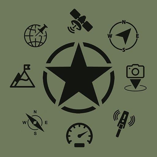
See the detailed description of each application included in our 13 in 1 kit below:
1. Magnetometer EMF Camera Metal Detector
Using this detector you’ll easily identify ferromagnetic metal objects (steel, iron, gold, pure silver).
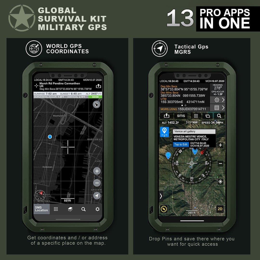
2. Digital Compass and GPS Info
- Dec Degs (DD.dddddd°)
- Dec Degs Micro (DD.dddddd "N, S, E, W")
- Dec Mins (DDMM.mmmm)
- Deg Min Secs (DD°MM'SS.sss")
- Dec Mins Secs (DDMMSS.sss")
- UTM (Universal Transverse Mercator)
- MGRS (Military Grid Reference System)
- Map
- True heading and magnetic heading
- Magnetic strength
- Slope level meter
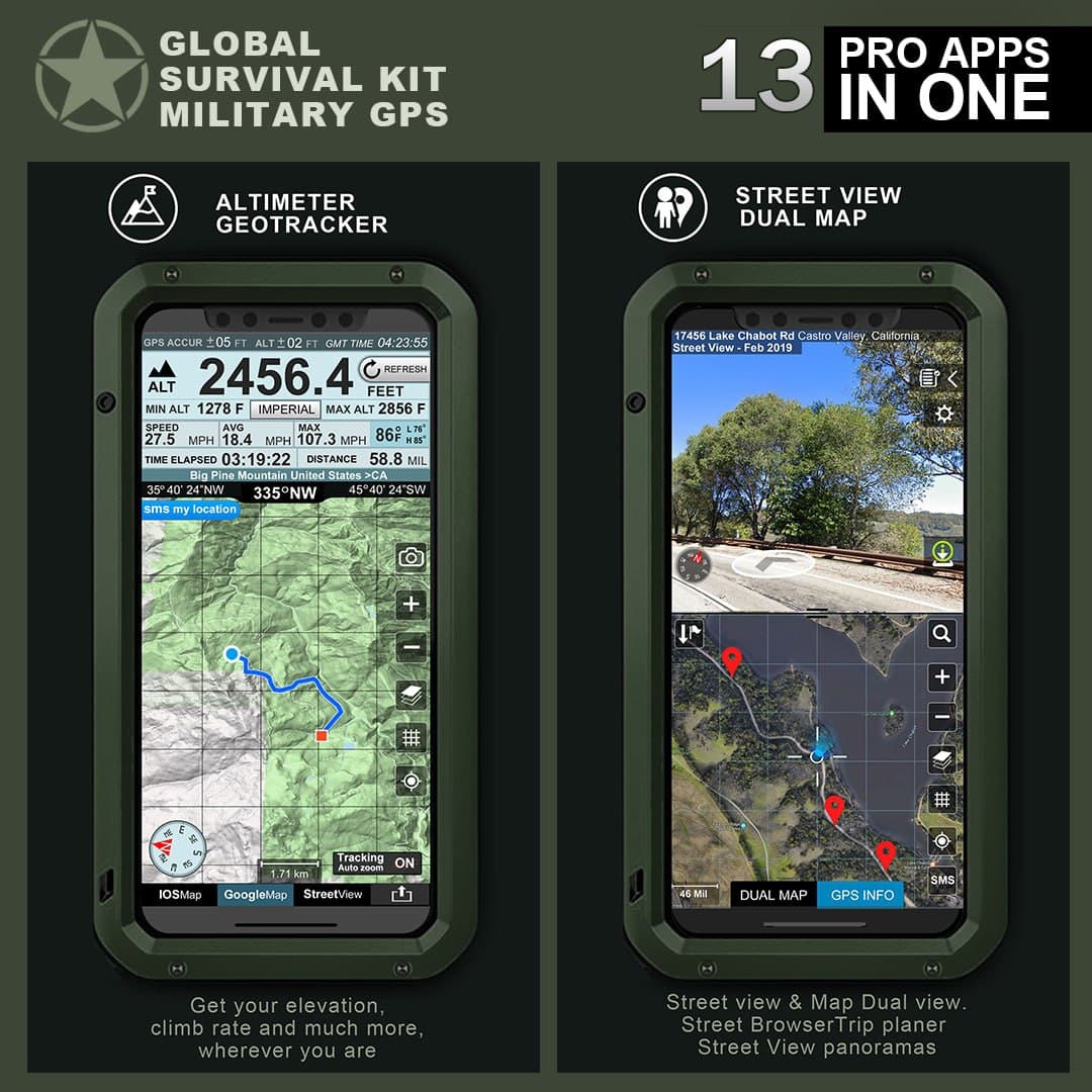
3. Altimeter Geotracker
Professional app for hiking and biking in mountainous terrain.
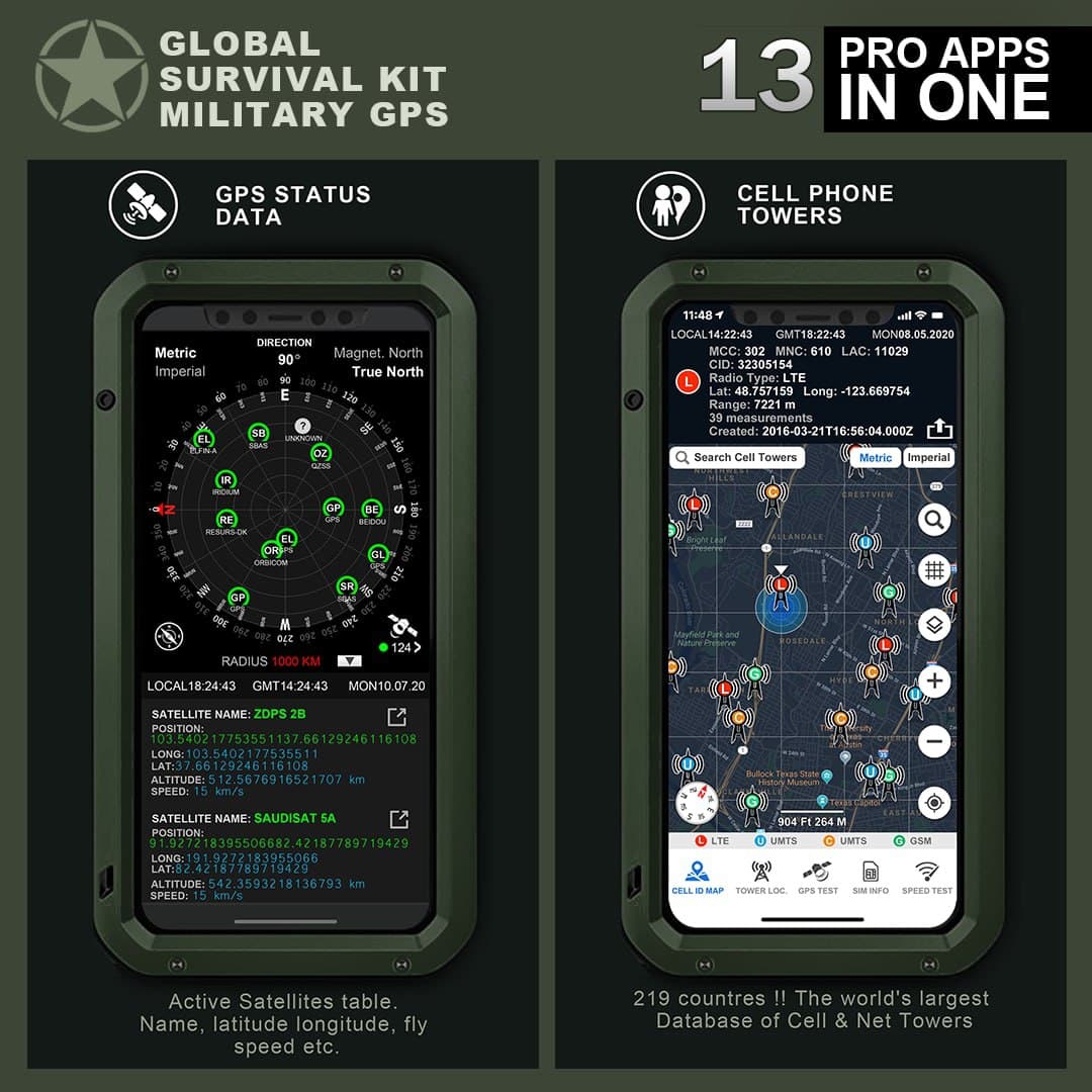
4. GPS Status Data, Satellite Info
Satellite info app is for the orbital element sets and related full info Active Satellites table. Find information like name, latitude longitude, fly speed etc. It can also be used for GPS tests, status and diagnosis.
5. GPS Stamp Camera
GPS Camera can help you to add the address, location coordinates direction, altitude, current date & time and note in the picture.There UTM, and MGRS
6. GPS Location Info
GPS Location Info shows your current location, date & time to the second along with a scrollable map. You can copy your coordinates & locate anything you can find on the map with accurate crosshairs.Drop pins and save where you want for quick access.
7. Street View Dual Map & All GPS Info
Dual Map is an easy way to view street-level images based on Google Street View Maps.
Double view with both a Map and Street View with full GPS info.Track your location on the map as you move around, drop and save pins with comments, save them in the library so you always have your favorite places with you!
8. Cell Phone Towers, Network Cell World Map, Wi-Fi Towers and Speed Test
Includes:
- CelliD World Map Coverage radius
The world Database of Cell Towers
Locate devices without GPS, explore Mobile Operator coverage and more
- Cell Tower Locator
Approximate position of GSM/WCDMA/LTE Cell Towers on Map. Towers are stored in Database. See Cell IDs, Signal Strength and GPS location.
- GPS Status GPS Test Data Tools
Check for GPS reception in your area, update AGPS data, GPS test and status! Also includes GPS receiver signal strength and signal to noise ratio.
- Supports GPS, GLONASS, GALILEO, SBAS, BEIDOU and QZSS satellites.
- Dilution of Precision
- HDOP (Horizontal), VDOP (Vertical), PDOP (Position)
With Military Survival GPS Toolkit you also get:
9. World GPS Coordinates
10. Speedometer
11. Binoculars
12. Night Vision
13. GPS Geo Camera
Related Apps + Games
View All-
Jungle Fighters Quest
by Android Booth
-

Galatea Games
by Alejandro Montón
-

Nightflyer
by Mil Qasemi
-

Vikings clan war: Adventure Saga Games 2018
by Nothing


