
Category
Description
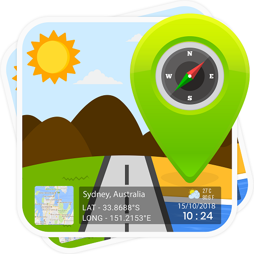
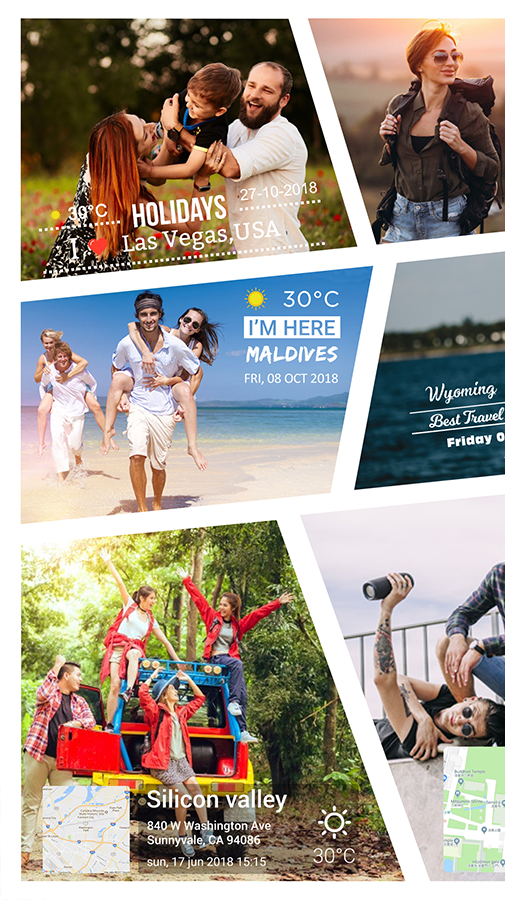
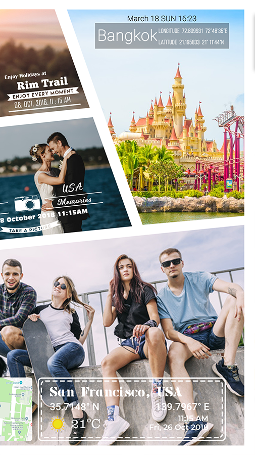
Easily add your location data on the gallery photos along with GPS Map Stamp & Date Timestamp! When you look back to your pictures, don't you wonder, "Where did I click that Pic?" Bingo! This Geotagging app helps you to rejoice those memories again by adding custom stamps including latitude, longitude, datetime, address stamp, local temperature, and much more!
Now you don’t need to search for ‘How to Geotag photos with my location?’. As we've made it easy for you to watermark photos with a GPS Map on pre-captured pictures!
* Who can make the most of this photography application?
- Adventure savvy people: Trekkers, Archaeologists, and Travelers.
- Onsite visitors: Civil Engineers, Architectures, etc.
- Event/Exhibition organizers: Fashion Shows or Destination Weddings.
The list is not over yet! There’s a lot more!
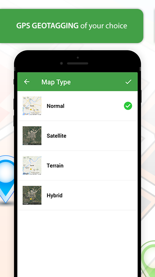
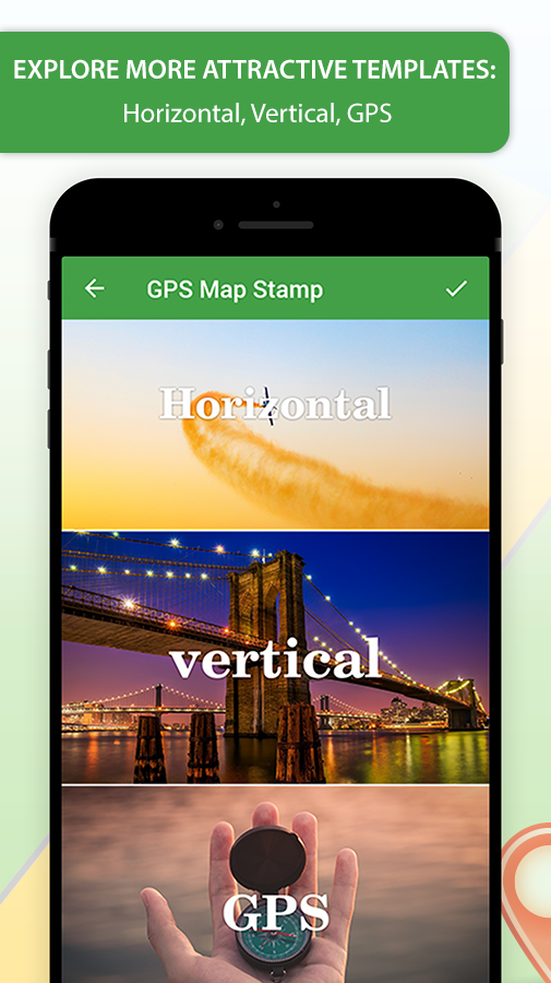
* Have a look at the collection of GPS Stamp templates for Geotag Photos with Timestamp:
- Local Temperature Units (°C or °F)
- Your Location Data (Detailed Address)
- GPS Maps (Normal, Satellite, Terrain, Hybrid)
- DateTime Stamp
* Simply select the template you like, Add/Edit the details & it will be portrayed on your Images in a flash!
This GPS Map Stamper is accessible with unique features that helps to relive your trips by virtually exploring the Locations.
* Variations in Geotag includes:
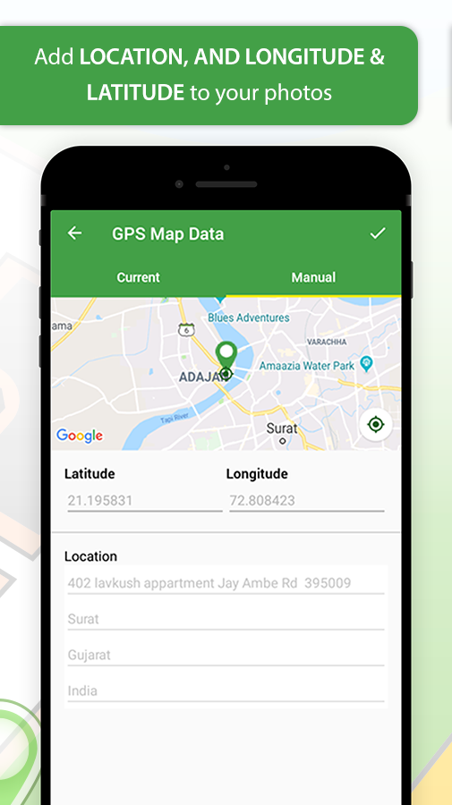
1) AUTOMATIC TAGGING
- Adds your current Location data on Images.
2) MANUAL TAGGING
- Drag & Drop Location “PIN” on Map; it will fetch the Latitude and Longitude Details.
- Add your Custom Address Stamps Information.
Related Apps + Games
View All-

RPAC Calculator
by RPAC
-

New pixel effect photo art editor 2017
by Shanzy Khan
-

Ballons Puzzles For Kids Farme
by PixieGames
-
Magnifying Glass - Zoom Camera
by Vasu infotech


